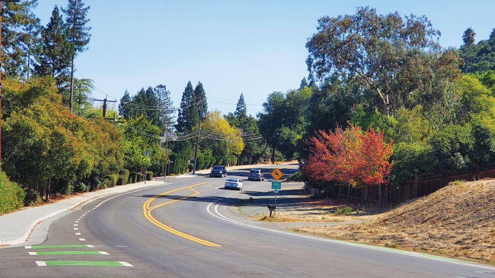
You don’t take Blossom Hill Road. It takes you.
The entire stretch of this legendary thoroughfare—from Los Gatos to the Evergreen foothills—provides rocking insight into the way San Jose was pieced together over the last 100 years. No one would possibly drive the whole thing from one end to the other, so I had to do it.
The first pieces of Blossom Hill Road that ever existed were in Los Gatos, going all the way back to the 1920s. It didn’t even used to go all the way to Winchester.
Even today, from Blossom Hill along the Gatos hills, you can see views of rooftops throughout the whole valley. Decades ago, from this vantage point one saw nothing but orchards and blossoms down below, even though there was never any official place called “Blossom Hill.”
From there, today’s version of the road barrels eastward into San Jose, that is, into a flat landscape of formulaic strip-malls, plus ghosts of wineries and several record stores. Sixty years ago, Blossom Hill Road didn’t go any further eastward than Camden, which was actually an extension of Hicks Road at the time. The entire stretch of Blossom Hill that now runs between Kooser and 101 used to be called Downer Road when nothing else existed but fruit trees and cow pastures. Then in the late ’60s Downer was renamed Blossom Hill in order to connect it up with the other stretch coming from Los Gatos. At that time, locals complained because Downer was named after a historic figure, while the name “Blossom Hill” was a misnomer. Typical San Jose, of course.
No one in my orbit would contemplate the history of this street without mentioning the surprise 1996 Metallica show at the Tower Records at Blossom Hill and Santa Teresa, a gig that put San Jose on the map all over the world. People far and wide still talk about that show. This was “placemaking” before anyone in City Hall ever used that term. The real estate syndicate currently angling to smash that strip-mall should be forced to pay for a huge plaque memorializing the famed Metallica show.
After more indistinguishable suburbia, Blossom Hill then crosses 101 and becomes Silver Creek Valley Road, a recent-as-of-25-years-ago phenomenon. From there it curls northward past country clubs, gated communities and estate neighborhoods, past street names like Quail Bluff, Beaumont Canyon Drive and Tweedsmuir, making it sound even worse than Atherton. Give me the corner of Blossom Hill and Camino Del Cerro any day.
Ultimately, Silver Creek Valley is a part of San Jose that doesn’t want anyone else to know it’s there. It’s like our own high-end snobbish equivalent of the gated Blackhawk development near Danville. Driving through the area, it feels like an entirely different county, reminding me that the majority of people in San Jose will never care what goes on downtown, or any urban place. And why would they?
Blossom Hill Road, from Los Gatos all the way past the former Tower Records and through the blasé squeaky-clean subdivisions of Silver Creek Valley, eventually becomes Nieman Blvd and concludes near Capitol and Aborn, totaling about 17 miles, if I paid attention correctly. Try it someday.
But it goes deeper. I grew up just off Blossom Hill Road but only recently did I contemplate the ancestral DNA that might have led me to this adventurous drive. My father grew up right on the old Grand Trunk Road in Jalandhar, India. The GT Road is about 2,000 years older than Blossom Hill Road and about 1,500 miles longer. Running from Bangladesh all the way across northern India to Peshawar in Pakistan and through the Khyber Pass to Kabul, the GT Road is one of the oldest and most historic geostrategic routes in Asia. Alexander the Great, Tamerlane and Genghis Khan all tried to navigate it, as did millions fleeing Partition in 1947, as did the CIA when supplying arms to the mujahideen. Metallica did not play there, unfortunately, canceling a concert near Delhi in 2011.
In terms of labeling historic roads, San Jose does nothing interesting except for El Camino Real. Maybe we should. Blossom Hill Road is history in the making. Take me away. Please.


In 1976 I was working for a contractor building a new house out past blossom hill off a side street that was row crops and orchards still. Living in LG meant driving Blossom Hill Road. It was always a busy to very busy street with backups on both sides of the one lane stretch you showed in your article. As a kid the spring view looking East towards Mt. Hamilton was a carpet of blossoms and gorgeous. Now the view from either end is as you put it, “Strip malls, shops and ‘just another suburbia.'” Todays reality is unless infill properties adjacent and contiguous there are no areas available to provide moderate cost housing. Much of the reason is hillside views, restrictive zoning and no government interest in reasonably priced housing. Any thoughts on how much population density before the Bay Area turns into ‘way too many rats in the cage,’ and self destruction? Good article Gary I’ll look through your Silicon Alleys and hope you included Fountain Alley.
Hi all! My grandmother named Blossom Hill Road. Our family ranch was named “Blossom Hill Ranch” and was located at the end of Union Avenue, where both roads ended, in that point.
It was a relatively small, but prosperous apricot orchard where my family would sun-dry the fruit for shipping. The original house, remodeled and white, is still there, it and the remaining orchard are in the loving-hands of a new owner.
Needless to say, I have many fond memories of growing up in that area.