home | metro silicon valley index | the arts | books | review

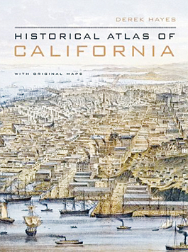
Historical Atlas of California
Review by Michael S. Gant
Although originally drawn to a purpose, after enough time maps become artworks that can stand on their own as portraits of the past. Derek Hayes' Historical Atlas of California proves the point on every page with a marvelous selection of maps charting the discovery, conquest, urbanization and touristifizing of our state. The well-annotated selections range from early images of California as an island (if only) and sketches of 49er gold fields to aerial views of San Francisco and earthquake-fault surveys. The graphically inventive tourist come-ons catch the eye with the same magnetism with which they lured early visitors. Two examples of San Jose and Monterey artist Jo Mora's delightful illustrated maps of California—full of tiny cartoon figures and landmarks depicting the state's attractions and history—bracket the text. A distorted California-centric map of the United States by Dudley Chase, done in 1940, anticipates in reverse the famous New Yorker cover with Manhattan dominant. Another surprise is an 1895 map depicting bike routes throughout the state, bordered with ads aimed at cyclists—proof that two-wheeling was a craze long before the invention of Lycra. Just to avoid complacency, the book includes two jarring realignments of the Golden State—one oriented east-west and the other just flat-out upside down.
(By Derek Hayes; UC Press; 256 pages; $39.95 cloth)
Send a letter to the editor about this story.
|
|
|
|
|
|